banner

San Pedro de Atacama

We will visit places less traveled, and limit our use of motorized vehicles in order to connect directly with our surroundings. We will visit tourist attractions near and around San Pedro de Atacama during non-peak hours to give you the solitude and raw outdoor experiences you are looking for.


banner

San Pedro de Atacama

We will visit places less traveled, and limit our use of motorized vehicles in order to connect directly with our surroundings. We will visit tourist attractions near and around San Pedro de Atacama during non-peak hours to give you the solitude and raw outdoor experiences you are looking for.

Cordillera de la Sal; 4WD, Hiking

My first visit to Moon Valley in 2003, was a memorable one, as I arrived to San Pedro de Atacama after a 700 km, 40-day ciclotourism trip that started in Altiplano of Arica in the Parinacota Region of Chile. I approached San Pedro on my bicycle, ascending the Llano de la Paciencia (Plain of Patience) nearing the Cordillera de la Sal (Salt Mountain Range). I then found myself at the base of El Anfiteatro (the Amphitheater) tired, unaware of a camping ban, and without a tourist in site, I put up my tent in the sand and enjoyed a warm, quiet, solitary night…..
Whether you choose to walk, bike, or drive to Moon Valley, on this day we will visit the Cordillera de la Sal (Salt Mountain Range), which is a mountainous system that is located in the middle of the Salar de Atacama (Atacama Salt Flat), parallel to the Cordillera Domeyko (Domeyko Mountain Range) and the Cordillera Occidental (Andes Mountain Range). Due to its special morphology, you might feel like you are on another planet, or shall we say “on the Moon”. To enhance the experience even more, we will walk through some caverns as well as in higher sections of the Cordillera de la Sal (Salt Mountain Range) where we will have the optimum view to watch the sunset, observe the sand dunes, and the work the wind has done in eroding certain formations.

Included:
• Refill water
• Snack
• Hiking poles
• Visit to Moon Valley

Altitude: 2400 - 2600 masl.

Duration: 4-5 hours.


Prices for group:
• In groups up 2 travelers: USD
• In groups up 4 travelers: USD
• In groups up 6 travelers: USD
• For 7 or more travelers, please consult for rates
• Entrance fee USD per person. Not included.

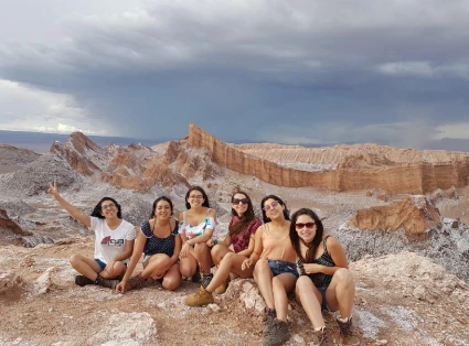
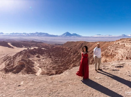
Group of 6 friends sitting on the ground, in the background is the Cordillera de la Sal. A couple, woman dressed in red and man dressed in white

Laguna Céjar, Ojos del Salar and Laguna Tebenquiche

On this excursion we will have the chance to visit the northern part of the Salar de Atacama (Atacama Salt Flat) and one of the lagoons formed by waters that emerge from under the surface of the salt flat. Its high rates of salinity due to the high concentration of salt causes “Aqueous Density” which creates buoyancy, causing travelers to float to the surface of the water. When we visit this region in the afternoon we will be able to watch the sunset over Laguna Tebenquiche (Tebenquiche Lagoon).

Included:
• Refill water
• Snack
• Swimming in Laguna Céjar
• Visit to Lagunas Ojos del Salar
• Visit to Laguna Tebenquinche.

Altitude: 2350 - 2450 masl.

Duration: 5 hours. (AM hours only)

Prices for group:
• In groups up 2 travelers: USD
• In groups up 4 travelers: USD
• In groups up 6 travelers: USD
• For 7 or more travelers, please consult for rates
• Entrance fee USD per person. Not included.

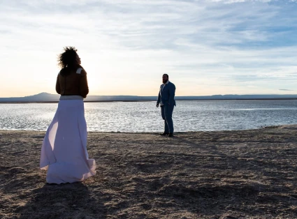
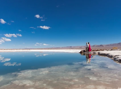
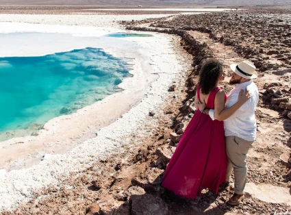
In the foreground a married couple, in the background Laguna Céjar. A group of friends at Laguna Tebenquiche

Salar de Atacama and Lagunas Altiplánicas, extension to Piedras Rojas

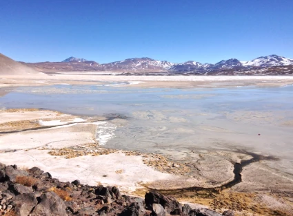
On this trip we will visit some of the most beautiful places in southeastern San Pedro de Atacama. We will visit the salt flat and learn about how it forms, Chaxa Lagoon where we can observe a variety of small birds, the endemic Fabian Lizard and the Andean, James, and Austral flamingos (depending on the season), among other species. Then, as we approach the volcanoes we will climb altitude and go up into the mountains where we can see the pre-puna vegetation also known as “tolares” that is located around 3,500 masl or 2,175 fasl. Once we reach the puna we can see flora and fauna native to the zone such as the Vicuña, Andean Fox or Culpeo Fox, and scrubland. We can also sight remains of past volcanic eruptions called ignimbrite (volcanic, pumice stone) fields. And finally we will experience the breathtaking views of two lagoons that were formed over 4,000 meters or 2,485 feet in the high-plateau, where we can observe the near endangered Horned Coot.

Being that it is a long expedition, the travelers will be consulted whether they prefer to continue to Piedras Rojas (Red Rocks) or return to San Pedro. Should the travelers choose to continue the journey, we will see high-plateau landscapes of a gorgeous color combinations and find ourselves enduring winds that remind us of our own fragility itself in these tough weather conditions.

Included:
• Refill water
• Snack
• Lunch

Duration:
9 hours, with extension to Piedras Rojas, 11 hours.

Altitude: 2350 - 4300 masl.

Prices for group:
• In groups up 2 travelers: USD
• In groups up 4 travelers: USD
• In groups up 6 travelers: USD

With extension to Piedras Rojas:
• In groups up 2 travelers: USD
• In groups up 4 travelers: USD
• In groups up 6 travelers: USD

• For 7 or more travelers, please consult for rates
• Entrance fee USD per person. Not included.

Atacama Salt Flat Altiplanic Lagoons

Tatio Geysers. (4WD, Hiking)

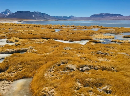
On this excursion we will visit the Geysers del Tatio (Tatio Geysers), the largest geothermal field in the southern hemisphere, where we will see the same waters rise above the surface that were heated 1 kilometer or .6 miles below the Earth's surface by the Tatio Volcano's activity. In order to arrive we must travel 100 km or 62 miles north of San Pedro de Atacama, ascending the high-plateau where we can visit a few wetlands with birds such as the Andean Coot, Giant Coot, Andean Gull, Andean Goose, Puna Duck, Juarjual Duck, Austral Flamingo, James Flamingo and animals such as the Vicuña, the Andean Fox, among others.

Included:
• Refill water
• Breakfast or lunch
• Visit to the Tatio Geysers
• Visit to the Geyser Blanco hot springs
• Visit to the Hidden Bofedal
• Visit to the Putana and Machuca Bofedal

Duration: 8 hours

Altitude: 2400 - 4500 masl.

Prices for group:
• In groups up 2 travelers: USD
• In groups up 4 travelers: USD
• In groups up 6 travelers: USD
• For 7 or more travelers, please consult for rates
• Entrance fee to the Tatio Geysers USD per person. Not included.

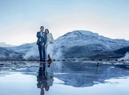
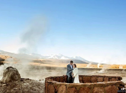
A couple in the Tatio Geysers A couple in the Tatio Geysers

Tatio Geysers with return to Calama. (4WD, Hiking)

On this trip we will visit the Geysers del Tatio, however, after having breakfast at 4,250 masl or 2,640 fasl, we will go directly west, through the quebrada Tchita (Tchita Ravine), crossing the Cordillera Domeyko (Domeyko Mountain Range) to visit the beautiful, untouched, traditional village of Caspana.

From here we continue the descent towards the west to cross El Desierto de Atacama (the Atacama Desert), the driest desert on Earth, until we reach the town of Chiuchiu, which is located on the banks of the Río Loa (Loa River). Here we can visit Chile's oldest church, built in 1611, with a cactus wood roof, supported by a beautiful adobe structure. If time allows we will visit the National Monument of Lasana Pukara, a Pre-Columbian fortress.

Included:
• Refill water
• Breakfast
• Lunch
• Visit to the Geyser Blanco hot springs
• Visit to the Caspana Village
• Visit to the Pukara de Lasana
• Visit to the town of Chiuchiu

Duration: 12 hours

Altitude: 2200 - 4600 masl.

Prices for group:
• In groups up 2 travelers: USD
• In groups up 4 travelers: USD
• In groups up 6 travelers: USD
• For 7 or more travelers, please consult for rates
• Entrance fee USD per person. Not included.

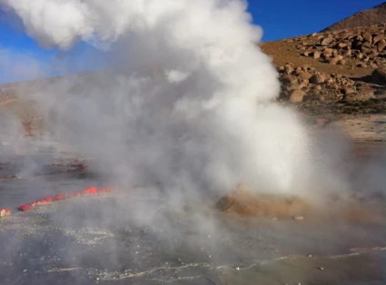
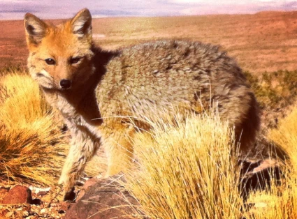
Water vapor emanating from the Tatio Geyser. Andean Fox

Cactus Valley and Puritama Hot Springs

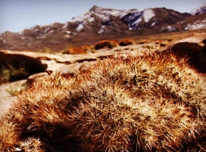
On this excursion we will ascend to the high-plateau, where we will visit the quebrada del Río Puritama (Puritama River Stream), where the cactus species Echinopsis Atacamensis abunds. Many of these cactus are more than 150 years old!

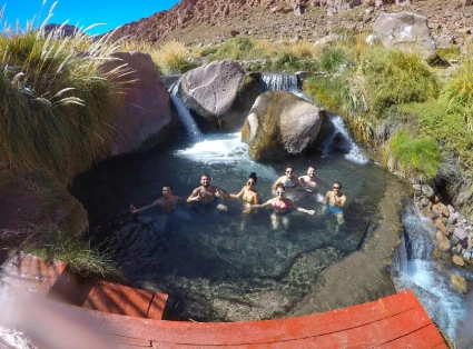
Then we will go to the Puritama Hot Springs (Puri meaning “water”, Tama meaning “hot” in the indigenous Kunza language), where we will find 8 pools varying between 28 and 32 degrees Celsius or 82.4 degrees to 89.9 degrees Fahrenheit. These waters are heated underground by the Volcán Putana (Putana Volcano) and then emerge from the interiors of the quebrada Putana (Puritama Ravine).

Included:
• Refill water
• Snacks
• Beverages

Duration: 4-5 hours

Altitude: 2400 - 3500 masl.

Prices for group:
• In groups up 2 travelers: USD
• In groups up 4 travelers: USD
• In groups up 6 travelers: USD
• For 7 or more travelers, please consult for rates
• Entrance fee USD per person. Not included.

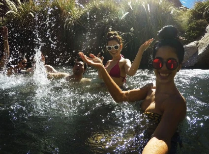
Grupo de amigos en Termas de Puritama Turistas disfrutando las calidas aguas en Termas de Puritama

Lagunas Escondidas de Baltinache and Vallecito

On this outing we will travel west through the Llano de Paciencia (Plain of Patience), which is one of the driest places in the Salar de Atacama (Atacama Salt Flat) and is located in between the Cordillera Domeyko and Cordillera de la Sal (Domeyko and Salt Mountain Ranges). After about an hour of travel through the Llano de Paciencia, which could test our “patience”, we will arrive to our destination, Lagunas Escondidas de Baltinache (Baltinache's Hidden Lagoons) where we will find 7 lagoons varying from light blue to turquoise that emerge from below the Earth's surface. Two of the seven lagoons are apt for swimming. Just as in the Laguna Piedra (Stone Lagoon), the high concentration of salts causes a sufficient density so that we can effortlessly float in the water.

Included:
• Refill water
• Lunch or snacks
• Beverages
• Visit to the Vallecito

Duration: 6 hours

Altitude: 2400 - 2600 masl.

Prices for group:
• In groups up 2 travelers: USD
• In groups up 4 travelers: USD
• In groups up 6 travelers: USD
• For 7 or more travelers, please consult for rates
• Entrance fee USD per person. Not included.

In the foreground Laguna Baltinache, a couple on the right A romantic couple in front of the Baltinache Lagoon

Tara and Pujsa Salt Flats

On this occasion we will travel east ascending a mountain that will quickly allow us to to arrive at 4,600 masl or 2,858 fasl to the high-plateau where we can spot springs formed by snowmelt from the high peaks. These streams form vegas (wetlands) like the Bofedal Quepiaco (Quepiaco Wetlands); these areas act as meeting places for several types of Andean birds such as the Juarjual Duck, Coot, Flamingos, Andean Gull, as well as others. We can see the fragil and timid Vicuña in its natural habitat of the high-plateau and if we are lucky, perhaps we will see a Anden Fox. Other species that are more difficult to spot but not impossible are the Suri or Ñandu and the Puma.

Then we will visit a salar (salt flat) less commonly visited called Salar de Pujsa (Pujsa Salt Flat), nesting place of the James Flamingo, which in cool weather can be found in the high-plateau and during colder months are found down in the lagoons of the Salar de Atacama (Atacama Salt Flat Basin). We can spot the Volcán Pili (Pili Volcano), meaning duck, and the Volcán Acamarachi (Acamarachi Volcano). meaning stone snail, in the indigenous Kunza language. The Volcán Acamarachi (Acamarachi Volcano) is also one of many Incan alpine sanctuaries where they would connect with their “Apus” or gods.

Next, we will travel northwest entering the Caldera la Pacana (Pacana Crater), a huge volcanic depression of 60 meters wide by 35 meters long or 197 feet wide by 115 miles long, where we will be able to see the latest erosionary acts which created the Monjes de Pacana (Pacana Monks), ignimbrite formations and statues, which continue to erode with the high winds, sands, and sediments of the high-plateau.

Later, we will cross over to the Salar de Tara (Tara Salt Flat) and Laguna Tara (Tara Lagoon) located within a protected wetland Sitio Ramsar (Ramsar Site) within Reserva Nacional de los Flamencos (The National Flamingos Reserve). You will be amazed by how immense, gorgeous, and pristine this site is. Internationally renowned photographers who have visited this site, have mentioned that it was one of the most beautiful landscapes they have ever captured.

Included:
• Refill water
• Lunch

Duration: 8 hours

Altitude: 2400 - 4800 masl.

Prices for group:
• In groups up 2 travelers: USD
• In groups up 4 travelers: USD
• In groups up 6 travelers: USD
• For 7 or more travelers, please consult for rates

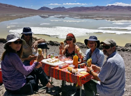
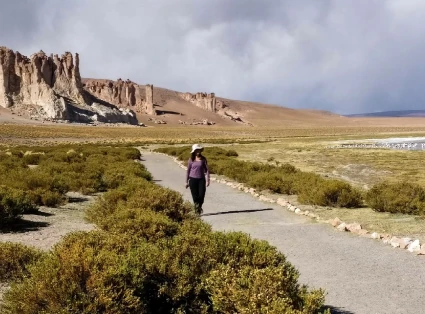
Lunch in the Pujsa Salt Flat. Woman walking in the middle of the desert

Valle del Arcoiris

On this occasion we will travel west, heading up into the Domeyko Mountain Range where we can spot the Guanaco, a Camelid similar to the Vicuña, however it is a bit larger in size and enjoys greater autonomy as it does not depend on having access to water currents to survive. We will continue going north until we reach the Yerbas Buenas sector, an ancient trade route where various types of exchange (goods, cultural, etc) occurred connecting the caravan traffic between the Chilean coastal towns and present-day northeastern towns of Argentina. The evidence of various cultures passing through this sector can be found in the petroglyphs or rock paintings which we will observe and attempt to interpret.

From here we will visit the Valle del Río Salado (Salty River Valley), a lovely valley which leads us to the breathtaking Valle del Arcoiris (Rainbow Valley). Here in this geological museum we will learn about the Earth's processes which gave origin to these colorful formations.

Included:
• Refill water
• Lunch or snacks
• Beverages

Duration: 5 hours

Altitude: 2400 - 3400 masl.

Prices for group:
• In groups up 2 travelers: USD
• In groups up 4 travelers: USD
• In groups up 6 travelers: USD
• For 7 or more travelers, please consult for rates
• Entrance fee USD per person. Not included.

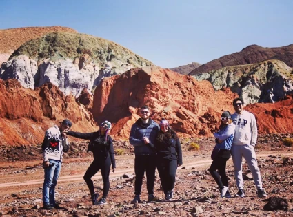
Groups of friends in the Rainbow Valley In the foreground a cactus, in the background a high plateau mountain

Pukara de Quítor, Valle de Catarpe and Garganta del Diablo

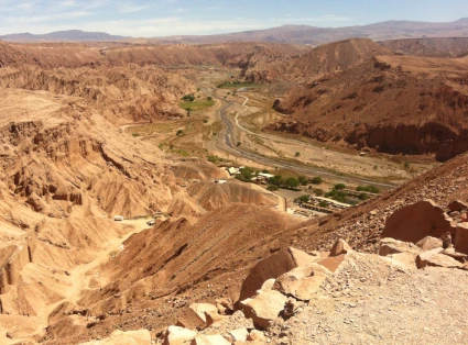
On this outing we will ascend the gentle slope of the Río San Pedro (San Pedro River) where we will encounter surprising views of the green vegetation of the Valle de Catarpe (Catarpe Valley) that contrast beautifully with the orange color palette of the Salt Mountain Range. Here the Incas did not only pass through on foot, but rather they installed themselves in the valley and constructed an administrative center in the 15th century. Later in the 16th century, the Spanish conquistadors finally defeated the Atacamenian people who took refuge at the Pukará de Quitor fortress, thus initiating the decline of the Lickanantai culture.

Included:
• Refill water
• Snacks
• Visit to the Pukará de Quitor (Pukará de Quitor Fortress)
• Visit to the Capilla San Isidro (Saint Isidore Chapel)
• Visit to the Garganta del Diablo (Devil's Throat Gorge)

Duration: 4-5 hours

Altitude: 2400 - 2500 masl.

Prices for group:
• In groups up 2 travelers: USD
• In groups up 4 travelers: USD
• In groups up 6 travelers: USD
• For 7 or more travelers, please consult for rates
• Entrance fee USD per person. Not included.
• Bike rental not included.

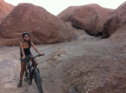
View of the Catarpe Valley Woman on bicycle in the Garganta del Diablo (Devil's Throat)

Llamas Caravan (Hiking)
Lickanantai Experience and Lunch in Thematic Restaurant.

On this occasion we will learn about the shepherding of llamas and the thousand year old history regarding caravan expeditions and the commercial exchange that occurred between the Atacamenian people and Amazonian and coastal peoples. We will walk among the llamas in the Coyo community or “ayllu” as the indigenous would say. Later, we will learn about traditions and customs of the native peoples, especially related to cooking as we will taste test some local products. We will finish the day at a restaurant where we will enjoy a delicious lunch made with local products.

Included:
• Refill water
• Local product tasting
• Lunch

Duration: 4 hours

Difficulty: Low

Altitude: 2400 masl.

Prices for group:
• In groups up 2 travelers: USD
• In groups up 4 travelers: USD
• In groups up 6 travelers: USD
• For 7 or more travelers, please consult for rates

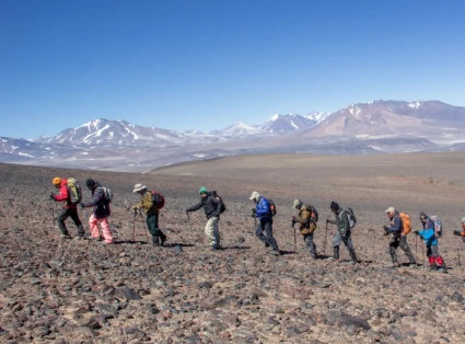
Camping in the altiplano Group of 10 people walking on the altiplano

Tocko Volcano Climbing (5.604 msnm), (VTT, Hiking, MTB).

This is an excellent hike for those who are looking to acclimate their bodies in preparation for climbs at higher altitudes like the Volcanes Licancabur and Ojos del Salado (Licancabur and Ojos del Salado Volcano). Also, due to the fact that it is a non-technical ascent, it is ideal for those are just beginning to climb at high altitudes (alpine mountaineering).

On this expedition we will travel east to the high-plateau until we arrive at the base of the volcano. Depending on the snow level, we will exit the 4WD and start our ascent between 5,000 and 5,200 meters. From here we will ascend for around two hours on a trail that will take us to the summit. Here on top of Mount Toco we will have a spectacular view of Volcanes Licancabur and Juriques (Licancabur and Juriques Volcanoes), as well as the Laguna Blanca (White Lagoon) to the north of us. Looking towards the south, with a clear sky we will be able to see the impressive Volcán Llullaillaco (Llullaillaco Volcano).

Alternative: Conquer Cerro Toco on bike. Enjoy a 2,800 meter or 9,186 foot descent starting at the base of Cerro Toco at 5,200 meters or 17,060 feet and finishing our trip in San Pedro de Atacama

Included:
• Refill water
• Individual Snack
• Isotonic drink
• Soup
• Hot beverages
• Hiking poles
• Gloves
• Balaclava

Not included:
• Bike rental
• Hiking boots
• Warm clothing
• Sunglasses
• Goggles

Difficulty: Moderate

Altitude: 2400 - 5604 masl.

Prices for group:
• In groups up 2 travelers: USD
• In groups up 4 travelers: USD
• In groups up 6 travelers: USD
• For 7 or more travelers, please consult for rates

Weather Conditions and Appropriate Hiking Season:
Can be visited all year. However, successful climbs completed to the peak have been completed in March and April and from July to December.

Duration: 7 hours (7:00 AM - 2:00 PM). Alternative: 9 hours

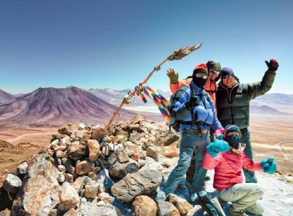
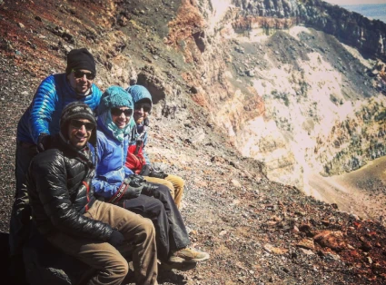
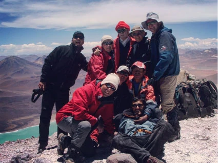
Group of 4 mountaineers on the summit of Tocko Volcano Group of 12 mountaineers on the summit of Tocko Volcano

Láscar Volcano Climbing

Volcán Lascar (Lascar Volcano) or Tongue of Fire as the locals say, is one of the most active volcanoes in the country, and constantly exhibits an active steam vent or fumarole. Its last eruption was in 1993 and the last significant volcanic activity occured in 2015. Due to its activity it is constantly being monitored.

Being that it is a day hike, it will also help you get used to the altitude so that you can climb higher volcanoes like Licancabur and Ojos del Salado Volcano should you choose. The hike is a bit steeper and more challenging than Cerro Toco (Toco Volcano), it will take about three hours to reach the crater and another forty minutes to reach the summit.

Near Volcán Lascar (Lascar Volcano), there are many other volcanoes that are recognized as alpine sanctuaries by the Atacamenian people such as the Pili, Chiliques, Tumisa Volcanoes. Lascar itself could have also been used as an alpine sanctuary, however any vestiges that existed in the past, are no longer, due to it volcanic activity.


Included:
• Refill water
• Breakfast
• Individual Snack
• Isotonic drink
• Soup
• Hot beverages
• Hiking poles
• Gloves
• Balaclava

Not included:
• Hiking boots
• Warm clothing
• Sunglasses
• Goggles

Difficulty: Moderate

Altitude: 2400 - 5600 masl.

Prices for group:
• In groups up 2 travelers: USD
• In groups up 4 travelers: USD
• In groups up 6 travelers: USD
• For 7 or more travelers, please consult for rates
• Entrance fee USD per person. Not included.

Weather Conditions and Appropriate Hiking Season:
Can be visited all year. However, successful climbs completed to the peak have been completed in March and April and from July to December.

Duration: 12 hours

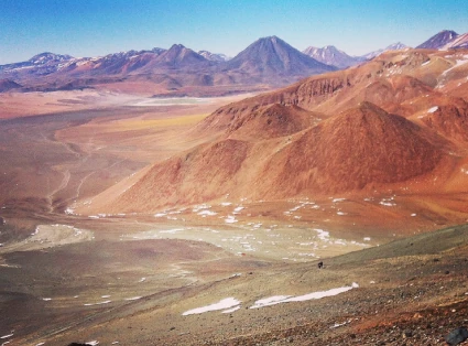
View of the valley from the Láscar Volcano Group of 4 mountaineers on the summit of Volcán Láscar, near the crater.

Licancabur Volcano Climbing

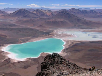
This volcano is undoubtedly the most impressive and striking one among those surrounding the Salar de Atacama basin, since it is possible to admire the 3.5 km vertical drop from its summit to the basin.

There are many stories about it, some true, others perhaps not… for example, we are certain that on the eastern side of the volcano, near its base, currently in Bolivia, lies the town of Licancabur, Inca ruins believed to have been used to rest before attempting the ascent to its summit, where there are also Inca ruins. It was even possible, a few years ago, to find pieces of cactus wood along the route up the volcano, wood that would have been used by the Incas to light fires at the summit. Another somewhat modern tale says that inside the small lake that sits in the crater of the volcano, a quartz sphere was found; it would have been misplaced in the lake by the diver who found it, and despite efforts, he could not retrieve it again.

This ascent requires acclimatization and prior high-altitude experience, though it is not a technical climb, it is physically demanding. On the first day we leave San Pedro de Atacama and move toward the Termas de Polque area. On the second day, we drive up to the base of the volcano, with the ascent taking about 6 to 7 hours, while the descent takes around 3 hours, returning to the refuge. On the third day we return to San Pedro.

Included:
• Refill water
• Dinner on first day
• Breakfast and lunch for second day
• Individual Snack
• Isotonic drink
• Soup
• Hot beverages
• Hiking poles
• Gloves
• Balaclava
• One night's lodging

Not included:
• Hiking boots
• Warm clothing
• Sunglasses
• Appropriate visa and fees paid for entry to Bolivia depending on your country of origin (current passport)

Difficulty: High

Altitude: 2400 - 5916 masl.

Prices from: USD, all included
• Check prices based on number of passengers
• Entrance fee to the Reserva Nacional Eduardo Avaroa (Eduardo Avaroa National Reserve) USD per person . Not included.

Weather Conditions and Appropriate Hiking Season:
Can be visited all year. However, successful climbs completed to the peak have been completed in March and April and from September to December.

Duration: 3 days.

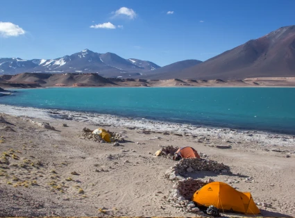
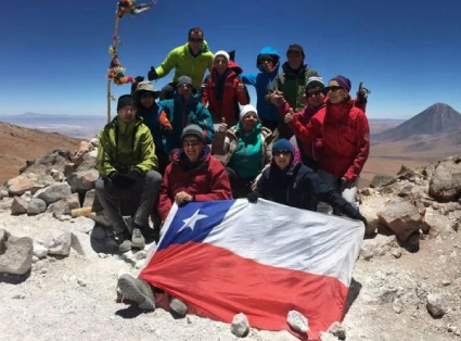
View from the Licancabur Volcano of Laguna Verde Group of 9 mountaineers on the summit of Licancabur Volcano

Arqueo Astronomic Tour

In the most strategic location of the Atacama Desert, where you can hear silence, you will connect your body, soul, and mind with the universe.

The tour is divided into three stages:
• First, there is an introduction and a scientific explanation about the birth of space.
• Then, the worldview and interpretation of the sky by the elders will be shared.
• Finally, there will be an observation of objects through the telescope.

Difficulty: no difficulty.

Duration: 2 hours.

Altitude: 2400 masl.

Price USD per person.

Groups: minimum 4 travelers up to 10 travelers.

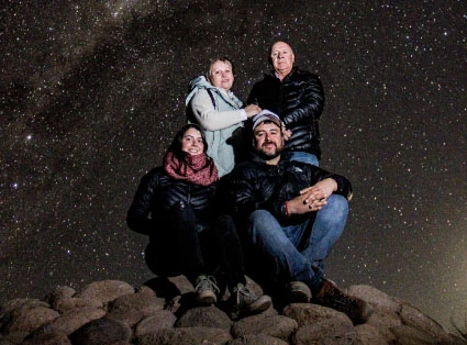
Astrophotography of a family in the atacama desert Astrophotography of a woman in the atacama desert

What to bring:

Download our recommendations